12 September 2022
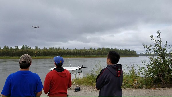
What do drones, dirt, and ice have in common? This is a question the Fresh Eyes on Ice team and visiting NASA science educators asked students and teachers at a recent visit to McGrath. As part of a science education project lead by Alaska Satellite Facility scientist Helena Buurman, 37 K-12 students located on the mighty Kuskokwim River built their own DIY drones, learned safety protocols and science applications, and then went through an intensive flight school.

Visiting NASA scientists Mariah Pulver and Jimmy Acevedo from Goddard Space Flight Center came to assist with flight school and generate aerospace excitement and learning among students.

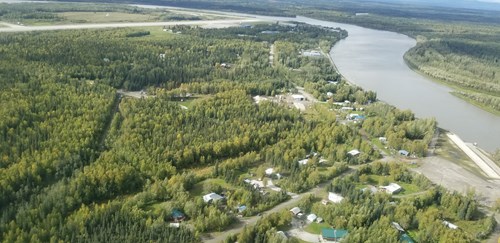
But what about dirt and ice? To link drones with river science applications, UAF scientists and McGrath students explored how and why the Kuskokwim River was so murky with silty sediment and how it’s monitored. Sediment (dirt moved by water) originates in the Alaska Range and is transported all the way down the Kuskokwim River to the Bering Sea because no dams block its path.
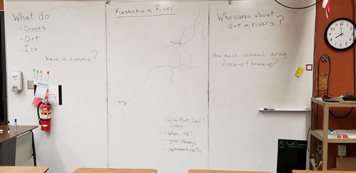
Measuring sediment with a turbidty meter can be done in the summer from boats or winter through the ice, but during fall freeze-up and spring-break up this is challenging. Together students and scientist explored a new technique to monitor this critical resource (sediment) during these “ice-challenged” seasons by using a turbidity-sensor slung from a drone. After testing the approach in the classroom, students and Fresh Eyes scientists ventured out to the Kuskokwim River and successfully collected sediment data while dodging pretend ice pans. Next steps will be to try this new technique with real ice on the Tanana River near Fairbanks. Many thanks to McGrath teachers, students, and community members for hosting our visit and looking forward to coming in again in March during the peak of ice season!