22 March 2021

The Fresh Eyes on Ice team is back from eight days of fieldwork on the Tanana, Kantishna, and Tolovana rivers! This trip expanded on efforts to collect river ice thickness data started during our previous four-day Wolf Moon shakedown in January.
We departed Fairbanks via the Chena River on Thursday, March 4 and made good time traveling down the Tanana River to our first campsite just upstream of Nenana by early evening. The weather was beautiful, if slightly chilly, and made for great conditions to collect our first data of the trip at Rosie Creek! We spent three nights at our camp near Nenana, traveling back upstream each day to collect data at other spots along the Tanana. We even found a scientific mystery near Hot Slough! After drilling holes in a jumbled ice zone, the pressure from the river caused water to well up and spill over the holes. We noticed some unexplained ice crystals, which appeared to be floating in the current, coming up and out of the hole! We’re still not sure why the ice crystals were there or how they formed, and we didn’t see them at any other location on our entire trip. We’re still puzzling over this exciting mystery!
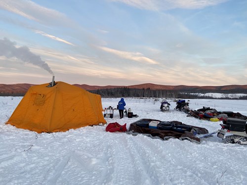
Camp on the Tanana River, upstream of Nenana. Credit: Sarah Clement
On the third day of our trip, we had the opportunity to meet with a few folks in our partner community of Nenana. Following careful COVID prevention safety protocols, we set up four different hands-on science stations for families to explore using ice drills, drones, and satellites in river ice science and a station to contribute their insights about current river ice conditions along our travel route. It was really fun - and felt so exciting! - to interact with members of our partner community outside after a long year of virtual meetings. We are very much looking forward to future gatherings as the pandemic is brought to an end. Thanks to Eric Filaridi of Nenana for helping us to make our first in-person science outreach event happen since COVID!
After breaking camp near Nenana, we snowmachined out the Commissioner Line Trail from Nenana to the Kantishna River, out to the Tanana, and then briefly up the Tanana to the Tolovana Roadhouse. We got to spend the next four days doing science based out of the Roadhouse, which was an incredible treat! As the days went by and we learned more about our snowmachines’ gas consumption habits, we realized that we might not have enough gas to stay out for our full trip. Not wanting to risk running out of fuel, and watching the forecasted temperatures dive towards the end of the week, we decided to head home a day early. This turned out to be a great decision as we limped into Nenana with almost all of our tanks running on empty and less than one gallon to spare! After a quick refuel we continued on our way back to Fairbanks, completing a long, 100+ mile travel day in windy and chilly conditions by early evening. It felt great to be back on the Tanana near Fairbanks, and we were amazed to see the changes upstream in the river after just a week!

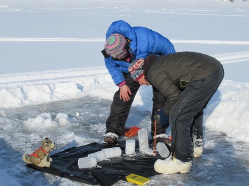
Chris & Melanie examining an ice core on the Tanana near the Tolovana Roadhouse. Ski Pup for scale. Credit: Sarah Clement

Chris measuring ice thickness on the Tanana near Rosie Creek. Credit: Sarah Clement
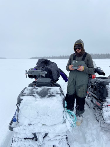
Allen launching the drone to take photos on the Tanana. Credit: Sarah Clement
River ice is hard to study because every river system is different, and conditions within a single river can vary widely across small sections. While we know that the timing of river freeze-up and break-up has been changing in our warming climate, we don’t actually know if, or how much, average ice thickness is changing. We set out to start answering that question on this trip.
Before leaving Fairbanks, we used Synthetic Aperture Radar (SAR) imagery to find late-freezing (open water) spots along our route, and marked those points on our GPS. We thought that whatever conditions had kept those spots unfrozen for longer than other parts of the river might also cause the ice that did eventually form to be thinner than surrounding, older ice. To measure this, we navigated to a safe distance from the identified open water spot (by the time we got there, they were all frozen) and went through a ice testing protocol to make sure the ice was thick enough to support us. When we determined the ice was thick enough to stand on safely, we drilled three holes in the late freezing “open water zone” and measured the thickness of the ice. We then drilled six more holes in older ice surrounding the open water zone: three holes in a “smooth” ice section, and three in a “jumbled” ice section. Our data consistently told the same story: the ice in the “open water zones” was just as thick as surrounding, older ice, meaning that the ice in the late-freezing areas grew faster than older ice to become a fairly uniform thickness.
By using SAR imagery to identify “open water zones,” we were also able to “ground-truth” the imagery and make it better for future classification. Our geolocated and dated pictures from on the ground will allow us to compare our pictures with what SAR tells us was happening on the river when we were out there. Using our observations from the trip, we can help teach SAR how to more accurately classify the conditions it records.
The variations in river ice conditions also make it difficult to understand how to travel safely on the ice. This uncertainty was a source of anxiety for us before both of our trips this winter, and we developed a robust set of safety practices for both traveling and practicing science on the ice. We thought the conditions in the Interior this winter would set us up for thick ice conditions: we had lower-than-usual snowfall in the first part of the winter, and the snow that did fall came early. After the snow fell, temperatures in late January and February were cold. All of this led to thick ice, which is what we found on the Tanana, Kantishna, and Tolovana. We felt good about our safety practices and our understanding of the conditions that led to thick ice this year, but we also know that everything can, and probably will, be completely different next year. To be secure from year to year, we need a lot of experience evaluating conditions on any given river.
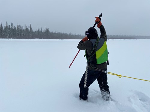
Chris tests the ice thickness following the Fresh Eyes on Ice Safety Protocol. Credit: Sarah Clement
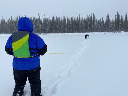
Melanie anchors Chris with a throw rope while he drills holes in the ice to test the thickness. Credit: Sarah Clement
Our 2021 fieldwork didn’t end up looking much like we thought it would when we first started this trip. The pandemic forced us to cancel our original plan to travel from Fairbanks to Bethel with stops in our partner communities along the way. Though we are hopeful that we can complete our original plan next winter, we are excited about the more local work we were able to do this winter, and look forward to analyzing our data this spring!