10 April 2025
By Steve Yoon (M.S. Student at Southern Methodist University)
The river was quiet, the only sound the hum of the engine, muted by the thick, white snow the ski-doo glides over—until, with a sudden crunch, the exposed ice beneath us ground against the studded tracks. For 3 days, we’d been ski-dooing our way across vast, frozen rivers and lakes near Fairbanks, Alaska, our GPS mapping the subtle shifts in elevation every second.

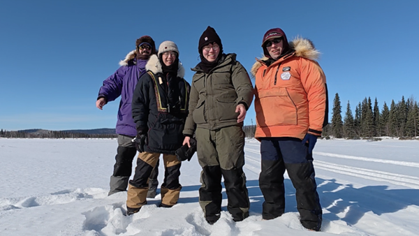
We’re the AK-SWOT Team, ice enthusiasts composed of Fresh Eyes on Ice’s Christopher Arp and Allen Bondurant, and SMU’s Xiao Yang and Steve Yoon. Xiao often jokes that our team sounds dangerous. He’s not wrong. We’re a force of cool science for river and lake ice!

We’re exploring whether NASA’s Surface Water and Ocean Topography (SWOT) satellite mission, originally designed to monitor liquid surface water, can be expanded for river and lake ice. SWOT surveys the extent and height of bodies of water globally, but many rivers and lakes freeze in the winter. Can SWOT still provide valuable data about frozen surfaces, such as ice thickness, surface conditions, or changes in elevation? SWOT is already a nifty instrument, and we’re excited by its potential to observe cryosphere processes like river ice jams or sea ice decline.

Xiao trekked through shin-high snow, piercing the surface with a magnaprobe to measure snow depth.

With experienced precision, Chris and Allen drilled through the ice and dropped a tape measure into the hole, demonstrating Fresh Eyes on Ice’s signature protocol for measuring ice thickness. It was an “ice” jam-packed fieldwork.

In addition to measurements, the fieldwork gave us a more complete understanding of our study region. I had analyzed countless satellite images of ice and snow before, but it was only when I stepped onto the ice for the first time that I truly began to appreciate the sheer complexity and uniqueness of this system. It’s quite breathtaking to witness the various zones of weird ice and snow dynamics that you might see within a single reach of a river.

The waters also welcomed us with some great open leads that are easy to miss on satellite images. I’m excited to potentially pair SWOT with Fresh Eyes on Ice citizen observations during break up!

It has been two weeks since Xiao and I left Fairbanks to return to Dallas. Upon reflection, I’m most thankful for the amazing time spent with Xiao, Chris, and Allen. Work like this would not have been possible without collaboration with Fresh Eyes on Ice. With a renewed sense of awe for the rivers and lakes of Alaska, it’s now time to dive into the literature and begin data analysis. We hope to return with more questions and science for Alaska!